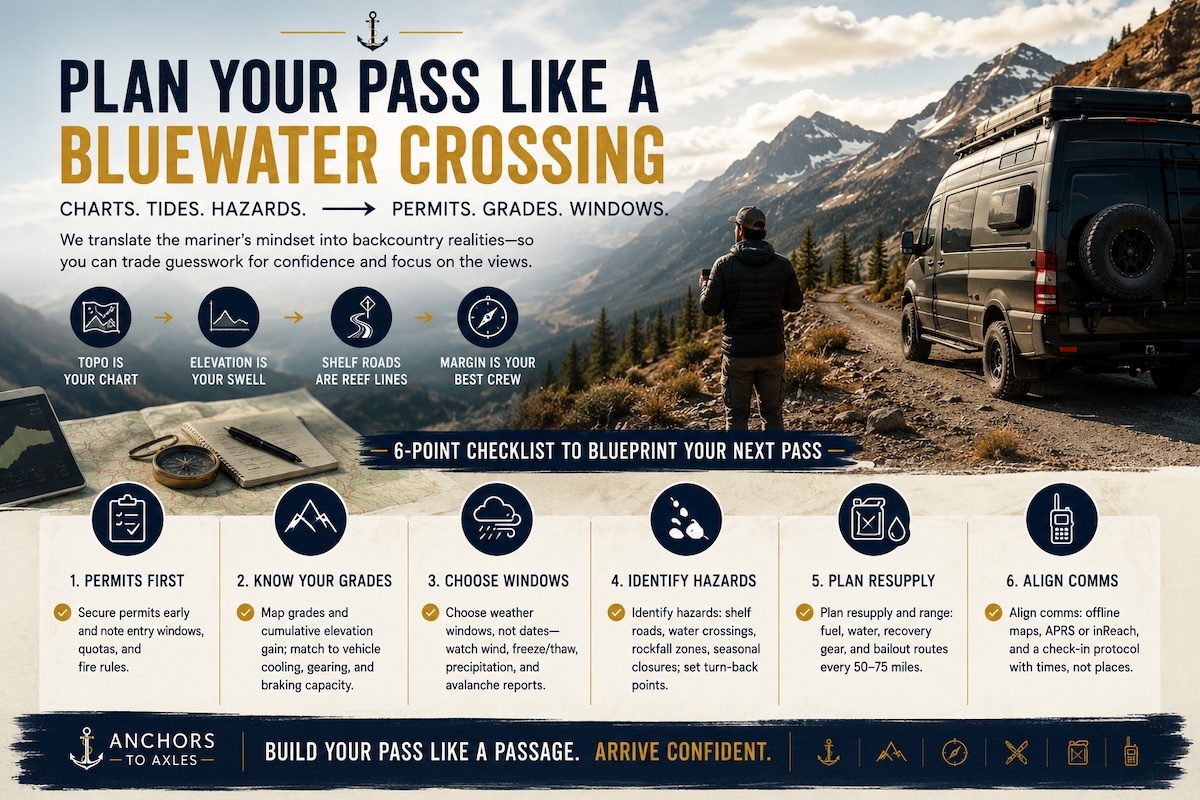
A navigation app can give you a two-hour drive without asking whether your trailer can make the turns or whether the pass will be icy when you arrive. Boaters already know this problem: a line on a chart is not a passage plan.
At Anchors to Axles, we connect life on the water with life on the road. Mountain passes make that connection especially useful. The discipline behind a good coastal passage translates surprisingly well to pavement, provided you know what changes.
Read the road like a chart
Charted depth matters only when you compare it with your boat’s draft. Road restrictions work the same way: they have to match the vehicle you are actually taking.
Record your loaded rig’s dimensions, including rooftop equipment and the trailer. Check actual loaded weights against the applicable vehicle and towing ratings. Then consult the state transportation department and the park’s own road information, not just the navigation app.
An open road is not necessarily a suitable road. Tight switchbacks or a length restriction can rule out your combination. An RV-aware routing tool can flag potential problems, but official restrictions and posted signs take priority.
Read the elevation profile, too. Grade length matters alongside the percentage: six miles of sustained descent creates a different braking demand from a brief dip. Mileage alone hides that distinction.
Put access windows on the itinerary
Tide tables give a passage plan a clock. Park reservations can put a clock on a road trip, too.
Some parks require timed entry during particular seasons or hours. Camping reservations and backcountry permits serve different purposes. A campground booking may change the entry requirements, but the park’s current rules determine how. One confirmation email is not proof that every part of the visit is covered.
Match each booking to the correct entrance. A campsite on the far side of a park may involve another mountain crossing, and the connecting road may not allow your RV.
Sometimes the sensible plan is to camp outside the park and explore in a suitable smaller vehicle, if you have one available.
Check the weather at road elevation
A sunny forecast in the gateway town says little about conditions thousands of feet higher. Check the National Weather Service forecast for the pass area alongside official road reports. Road cameras add context, but one clear image is not a forecast.
Look at conditions around your expected crossing time, particularly on exposed sections. Strong crosswinds deserve attention with a tall RV or trailer. Snow and ice can still matter when the valley feels comfortably out of winter.
Verify seasonal closures and applicable chain restrictions with the responsible road authority. An early start is not automatically safer: it might avoid worsening weather, or put you on pavement still icy from overnight freezing. The conditions, rather than a universal departure hour, set the window.
Plan the descent before the climb
Getting uphill is only half the crossing. The downhill side belongs in the plan before you reach the summit.
Confirm that tow vehicle and trailer brakes are in working order. Tires and the cooling system also deserve attention before a demanding mountain route.
Follow the vehicle manufacturer’s downhill towing guidance. Select an appropriate lower gear before descending, and use engine or exhaust braking where equipped, as directed. Riding the service brakes can overheat them.
Locate pullouts that can accommodate your entire combination. A scenic-overlook symbol does not promise trailer maneuvering room. Neither does a wide-looking patch on a satellite image.
Write a route card instead of collecting pins
Imagine a truck and travel trailer approaching a national park over a high pass. The useful itinerary includes decisions, not just destinations:
- Spend the previous night at a confirmed campground near the approach, avoiding a long drive before the climb.
- Recheck the summit forecast and official road status before departure, while you still have a signal.
- Set a departure cutoff by working backward from the park-entry window and available daylight. Allow for slower mountain driving and a fuel stop.
- Identify the last suitable place to turn back before committing to the climb.
- Arrange a fallback, whether that means a lower-elevation route or a confirmed place to wait another night.
The alternate route deserves the same scrutiny as the first choice. A detour onto a narrower mountain road has not solved the problem.
Save maps and permit confirmations offline. Keep the departure cutoff and fallback decision on the same route card, where they are easy to find when plans start slipping.
A reservation is a scheduling constraint, not a reason to force a crossing. A trustworthy itinerary leaves room for the mountain to say no.
Follow us at Anchors to Axles for more practical boating and RV travel content, including the planning and systems work behind the adventure.